Linville Gorge
- Location
- Description
- Directions
- Cliff Access
- Guidebooks
- Sections
- Routes (link)
- Land Manager
- Emergency Information
- Gear
- Facilities
- Seasons
- Miscellaneous
- Yahoo Scalable map -
- topo map (TopoZone.com link)

- Linville Gorge Photo Gallery (link)
- Access Notes
- Links
- Southeast Climbers Registry - NC
- Trip Reports
- Enlarge photo above
Location
Locator map (link Topozone.com)
Top of page
 Description
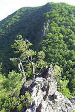
Linville Gorge offers mutli-pitch traditional climbing on some of the oldest exposed rock on the face of the earth, high quality granite with crystalline quartzite extrusions. The rock presents in large formations along the crest of Jonas Ridge and as long canyon walls once the ridge subsides. The cliff walls return again as Shortoff Mountain rises at the southern end of the gorge.
The most popular access point for Linville Gorge is Table Rock Mountain. Even so, it is a nine mile drive on gravel roads that can be in rough shape, then another 30 minutes to reach the nearest town of any size, Morganton. A second access point can be used for Shortoff Mountain by making a different approach from I-40 via Lake James - Nebo. Foot trails connect these two points.
Enlarge photo of Jason
Top of page
 Directions
Approaches differ for Table Rock and Shortoff Mountain
Table Rock Parking Lot
From Morganton, North Carolina, drive north on SR 181 as it winds up into the mountains. In about 1/2 hour you will see a sign for the Table Rock Picnic Area (picture 1) directing you to a graded road on the left (Rose Mountain Road). If you take this route (don't), it is 13 miles on a rough road.
 Most of us continue uphill on 181 a few more miles until we come to Gingercake Road road at "Gingercake Acres" (picture 2) at the top of the incline. There are signs here for both Gingercake Acres and Table Rock. Take Gingercake Road uphill (left), when it forks, continue on the higher road (left).
 It will soon degrade into 8.5 miles of dirt and gravel as you leave the neighborhood. This road winds down through the forest from Gingercake Ridge and follows Jonas Ridge. It is normally passable by low clearance vehicles, cars, etc., though sharp turns can get deeply rutted. 4-wheel drive is not necessary. Watch for a sign for the turn off for Table Rock (picture 3), and follow the dirt road upwards.
 You will pass the Outward Bound Center sign (picture 4) one mile from the top. The last section of road is paved due to its steepness, a series of tight switchbacks that wind up to the small 16 car parking lot at the top. The parking lot usually fills by the middle of the day on weekends, with parking along the road. This last section of road is gated, with the gates closed during the winter from January 1st - March 31st. You can park below the gate and hike up for winter climbing. There is also a foot trail from the Outward Bound Center.
Shortoff Mountain Trailhead
Leave I-40 at the Lake James / Nebo exit. Follow Harmony Grove Road to NC 126. Follow NC 126 for about 12 miles. Look for Wolf Pit Road on the left. Follow Wolf Pit road as far as you can. There is a small parking area at the end. This road becomes increasing rough as you climb. The last section may not be passable by cars and other low clearance vehicles, especially during rainy periods. Park here, then follow the trail until it intersects the Mountains-to-Sea-Trail (white blazes) and on to the top of the cliffs on Shortoff Mountain.
Top of page
Cliff Access
The Mountains-to-Sea-Trail (link to NCTS site) connects almost all of the features along Jonas Ridge and is easily accessed from the parking lot at Table Rock. Following it south 15 minutes brings you to the Chimneys. It continues all the way (6 miles) to Shortoff Mountain. Side trails lead to the North Carolina Wall and the Amphitheater.

Sections of some cliffs are periodically closed to climbing for the protection of nesting peregrine falcons. These closures most commonly affect Shortoff Mountain and The North Carolina Wall. They are in effect from January 15 - August 15. If it is determined the birds have abandoned a nest or moved, the area may be reopened.
Top of page


 Guidebooks
 The Climbers Guide to North Carolina by Thomas Kelley. Included are descriptions of Sitting Bear, Hawksbill, Table Rock, Little Table Rock, Devils' Cellar, the North Carolina Wall, the Amphitheater, the Reggae Wall, and Shortoff Mountain.
Southern Rock by Chris Hall
Selected Climbs in North Carolina - Yon Lambert and Harrison Shull.
Top of page
 Table Rock Mountain - traditional climbing
 (Enlarge photo of Table Rock) Table Rock Mountain is the hub of climbing activity in Linville Gorge. From the parking lot, trails lead to the summit of Table Rock (1 mile), Little Table Rock, The Devil's Cellar, and along the base of the cliffs on the south, east and north sides. Table Rock slopes up from the south end rising to about 400 ft. at the northern tip. The climbers you see from the parking lot are on the South End of Table Rock. The Mountains-to Sea-Trail passes on the back side of rock. From the summit, Hawksbill Mountainand Sitting Bear pillar can be seen to the north, The Chimney's and Shortoff Mountain to the south. Grandfather Mountain, Boone, Blowing Rock, Beech Mountain, the Blue Ridge Parkway are all visible from the summit.
To get to the South End of Table Rock, follow the summit trail leaving from the sign at the parking lot. Turn to the right at the first junction. You will pass a small nondescript trail that leads to the south face as you round the bend. Work your way up this small trail to emerge near Crackerjack 5.8 on the South End. There is a 4th class scramble to the summit nearby. You should be comfortable leading 5.8 to climb at the South End. Many more difficult routes can be done here.
 The most popular face is the East Face. It has a fine collection of well protected moderate 2 and 3 pitch routes that are great to learn on or bring new climbers. Routes can be combined to access the summit. Continue around on the trail passing the base of some cliffs along the east face. The trail will work it's way to the first obvious (and most popular) climbing spot, the small clearing below Peek-a-boo 5.5 / Jim Dandy 5.4. You will pass a tree, step down, then the trail will break up and to the left passing through rhododendrons. There is a well used platform at the base of the climb. There are almost always a bunch of climbers here. You will also probably find a group a little further up the trail at The Cave Route 5.4 - This is the easiest route on Table Rock.
 Rounding the corner from the East Face is the North End. The Lunch ledge is above, with a gully that leads down to the trail. The Cave Route is the last climb on the east face low, My Route 5.6 is above the Lunch Ledge. The trail gets steeper and encounters passes through rhododendrons to finally crest at the base of the North Ridge 5.6, and excellent climb, usually done in two pitches, but can be taken to the summit for bushwhacking types. (Enlarge photo of Chase)
Other great climbs here include Peek-a-boo 5.5, Jim Dandy 5.4, The Cave Route 5.4, Blood, Sweat, and Tears 5.7, Helmet Buttress 5.6, My route 5.5, Block route 5.5, K-Mart Special 5.5, Crackerjack 5.8, North Ridge 5.6, True Grit 5.8+, No Name 5.10, The Wasp 5.8, Rip Van Winkle 5.7, Second Stanza 5.9
Table Rock topo (link TopoZone.com)
Peek-a-boo 5.5, Jim Dandy 5.4, The Cave Route 5.4 (link to route descriptions)
Top of page
 Devil's Cellar - top roping, traditional climbing
 Rounding the north corner from the North End of Table Rock, you can continue back along the west side of the rock where you will come to The Devil's Cellar. It is more commonly accessed from the parking lot by taking the summit trail. About half way up the mountain, look for a side-trail (left) which branches off through rhododendrons. You emerge at the top of the chasm.
The Devil's Cellar is the chasm formed by a large buttress of rock that stands almost parallel to the steep west face of Table Rock. One end of the buttress runs in to Table Rock. A gully descends steeply to the bottom of the rock where a cave is found. The Devil's Cellar probably got it's name from the cave beneath the floor of the chasm.
This is a popular top-rope and rappelling area because it is easy to rig anchors to the trees and boulders atop the west buttress. There are also some traditional routes to be found on the walls of the Devil's Cellar and the north face of the buttress. Quiver 5.7 is a nice one.
Enlarge photo of the Devil's Cellar
Devil's Cellar - topo (link TopoZone.com)
Top of page
 Little Table Rock - traditional climbing
 Little Table Rock juts out into Linville Gorge on the west side of Table Rock. It is connected by a narrow saddle which is accessed by a left branch off the summit trail. It is quite small compared to Table Rock and is mostly used for the few good campsites found here. Excellent views of the gorge can be seen from the west edge. There are some nice cliffs here and the guidebooks detail some climbs here, but I've never bothered.
Enlarge photo of Table Rocks
Little Table Rock topo - (link TopoZone.com)
Top of page
 The Chimneys - top roping
 The Chimneys see at least as much visitation as Table Rock. A 15 minute hike south on the Shortoff Mountain Trail (Mountains-to-Sea-Trail) brings you along one of the narrowest portions of Jonas Ridge. Side trails lead to some great views looking back towards Table Rock from atop several outcroppings. A little Further and you came to Polaroid Point with excellent views into the Gorge. From here, drop sharply, then up over and through a narrow cut in the rocks. The Chimneys will be found on the left side of the point where the trail enters a rhododendron tunnel.
About 30 feet high with ways to scramble on top and rig anchors, the Chimneys are used almost constantly for groups of top rope climbers. Good views can be found on top.
Enlarge photo of the Chimneys
The Chimneys topo - (link TopoZone.com)
Top of page
The North Carolina Wall - traditional climbing
 I have not had the opportunity to climb on the North Carolina Wall, you'll have to refer to the guidebooks. This area closes periodically for peregrine falcon nesting season January 15 - August 15. The NC wall lies within the Wilderness Area. Permanent anchors are prohibited, see Access Notes for details.
North Carolina Wall topo - (link TopoZone.com)
Peregrine Falcon Closure info - Note: The NC Wall has been added to the closed list (until July 1, 2004) due to the Forest Service’s efforts to protect the threatened plant Hudsonia montana (description). Photos of this rare plant can be found here .
See larger photo of the North Carolina Wall
Top of page
 The Amphitheater. - traditional climbing
 (Enlarge photo) The Amphitheater is a small canyon off the main walls of the gorge. It is bounded on the north by The North Carolina Wall. The Prow 5.4 climbs the corner formed. On the south side, the small canyon opens quickly to reveal the Mummy Buttress near the end of the wall. Plan on 45 minutes for approach and retreat, 1.5 hours of your day on the trail.
From the Table Rock parking area, follow the Shortoff Mountain Trail (Mountains-to-Sea-Trail) from through the camping area south toward Shortoff Mountain. There are a few secluded campsites along the trail (please don't use them - too much exotic plant life has been destroyed here). You pass by Polaroid Point, a flat rocky outcropping on your right, with panoramic views of the Gorge (great for sunsets). You will soon come to a narrow slot through a large rock, then pass by some large outcroppings on your left, The Chimneys. Pass through the damp tunnel of aromatic rhododendrons. Access to the North Carolina Wall is via an elusive trail(s) on the right.
Enlarge photo of Stu on The Mummy
Watch for a trail on the right when you've hiked for about 1/2 hour on the Shortoff Mountain trail. There is white quartz rock in the ground on the right side of the trail marking the right turn onto the Amphitheater trail. The pine tree on the left that has a white rock wedged in a crook has fallen over, as have most of the pines in the area. If you haven't made a right turn and the Shortoff Mountain Trail starts descending steadily into the gap, you've gone too far.
Once you turn right towards Linville Gorge and the Amphitheater, the trail will start a winding descent. The trail snakes through an area that is recovering from fires that burned through the gorge a couple of years ago. Almost all of the pine trees were weakened by fire and succumbed to beetle infestations the next year. Most have fallen. Underbrush is filling in, some of it very dense. After 10+ minutes you'll reach the top of the north wall of the Amphitheater. It is worth the effort to continue out onto the end of the north wall to survey the area below and identify climbs and landmarks. Be sure to look down from the end. There is a trail to a campsite atop The Prow on the right, about 1/3 of the way out the north wall.
To get to the floor of the Amphitheater, find the descent gully. It's on your left as you emerge onto the north wall, at the point where the trail leaves the woods. It's a steep, wet, muddy, slippery chute through a tangle of rhododendron, which will deposit you on the top of the sloping floor of the Amphitheater. Returning via this chute may not be feasible, depending on conditions, though erosion has made it a bit easier lately.
 The three most popular climbs in the Amphitheater are The Mummy, The Daddy, and The Prow (link to route descriptions). The Mummy and the Daddy are located on the Mummy Buttress and are visible from the top of the North Wall of the Amphitheater. The Prow ascends the sloping face that runs from the bottom of the amphitheater to the top of the North Wall. I'll do my best to describe how to get to them and get back, but don't expect any verbal or written description to be adequate. It is a steep jungle down there, use proper footwear. On your first visit, it is best to bring someone familiar with the area.
Once you get to the bottom of the descent gully, cross the small wet area. There is sometimes a small waterfall here after a good rain, though it is most often a dry, rocky, fern-filled stream bed. Cross the rocky stream bed, and turn immediately right following trails descending along it. Don't be fooled into following the good path high along the South Wall once you cross the stream bed if you want to do one of the three popular routes. Follow the path of the water down instead.
Bushwhacking and scrambling along the most worn paths will lead you down the floor of the Amphitheater, crossing from north to south (right to left). You will reach a point where the trail strays away from what little remains of the stream bed, towards the south wall after you descend around a short rocky face with a shallow cave. If you want to climb The Prow, I suggest you break trail for the base of the North Wall from just below this boulder.
Mummy Buttress
 To access The Mummy and The Daddy, continue on the "trails" toward the south wall. Identify the Mummy Buttress on your left from the north wall before you descend, then whenever possible as you progress towards it's base. link - topo map on Mummy Buttress photo. Look for the large belay ledge the serves as the second belay ledge for The Mummy. Follow the crack down from the right end of this long ledge to find the start of the climb. It is hard to identify because the crack does not go all the way to the ground, but it will be found near the point where the trail first touches the wall on the Mummy Buttress. It is usually wet at the base with some moss on the climb. If you think you've found The Mummy, continue down from here a short distance to gain access to the base of The Daddy. The base of the Daddy is the most obvious because of all the traffic. The first pitch ascends a right corner to a pine tree atop a small buttress.
The return path from routes topping the Mummy Buttress runs along the top edge of the South Wall of the Amphitheater, with areas of sheer drops, thick brush, and confusing trails. Use caution. Find the trail on top of the Mummy Buttress, follow it to where the buttress attaches to the main wall. Cross here, follow the trail up and to the right, passing a line of 40 foot cliffs. Climb up the trail at the end of the cliffs, turn left, towards the Amphitheater. Follow the trail, always taking the higher trail whenever it meets another. You will circle around the top of the canyon, and find the trail out just beyond a large rock. Good luck!
Amphitheater topo - (link TopoZone.com)
The Mummy, The Daddy, and The Prow (link to route descriptions)
Enlarge photo of the Mummy Buttress
link - topo map on Mummy Buttress photo
Top of page
 Shortoff Mountain - traditional climbing
 Shortoff Mountain is a good place to go to avoid the crowds. The rough approach road and the long hike into the wilderness area makes discourage the weekend crowds. The trail brings you in at the top of the cliff line after 45 min - 1 hour hiking uphill. There are some great campsites located here. The long faces have a good number of excellent multi-pitch traditional routes. The cliffs bottom is accessed via a gully in the middle of the face. 3rd class scrambling brings you onto the sloping floor, trails split north and south. Fires here in 2002 have altered the landscape considerably, trails may now be overgrown. Good routes here are the Maginot Line 5.7 and Dopey Duck 5.9
This area closes periodically for peregrine falcon nesting season January 15 - August 15. This areas lies within the Wilderness Area. Permanent anchors are prohibited, see Access Notes for details.
Enlarge photo of the cliff face
Shortoff Mountain topo - (link TopoZone.com)
Top of page
 Hawksbill Mountain - traditional climbing
I've not had a chance to visit Hawksbill Mountain. The cliff faces can be seen from the top of Table Rock. You'll have to consult the guidebooks.
Hawksbill Mountain topo - (link TopoZone.com)
Top of page
Sitting Bear - traditional climbing
Sitting Bear is a small pillar with a handful of climbs on it. I have not visited.
Sitting Bear topo - (link TopoZone.com)
Top of page
Grandfather Ranger District
Pisgah National Forest
US Forest Service
109 E. Lawing Drive
Nebo, NC 28761
(828) 652-2144
National Forests in North Carolina http://www.cs.unca.edu/nfsnc/
Top of page
Burke County Emergency Service 828-437-1911
NC Outward Bound Table Rock Base camp 828-437-6124
Grace Hospital, Morganton 828-438-2000
The telephone number for the Grandfather District Ranger's Office in Nebo, NC is 828-652-2144.
You are in Burke County.
Top of page
Light to medium rack adequate, no need for small or large extremes. The rock is usually featured enough that it takes gear well. I found larger hexes useful, rock takes nuts and tricams well. 50 meter ropes adequate, some double rope rappels. You can go pretty light if your just climbing at Table Rock, but if your planning a descent into the gorge, be prepared. Plan extra time for approaches and exits from Linville Gorge - they can often be more strenuous than the climbs. Be prepared for sudden weather (thunderstorms), darkness, cold, self rescue.
Top of page
Facilities:
 No public water supply. There is a small spring located on the west side of Table Rock accessed by a trail that leads down from the saddle between Big and Little Table Rock. A plastic pipe delivers water fresh out of the rock. There are usually trickles of water to be found on the floor of the Amphitheater.
 Primitive camping is permitted just beyond the parking lot in the wilderness area with permits, but not in the picnic area. (There appears to be no enforcement, you will see people camp amongst the picnic tables at times, please observe the rules). The further back you move, the less intrusions. Friday night sees many late arrivals, often youth-group van / bus loads. Theft / vandalism is rare. Table Rock has new bathroom facilities. There are trash cans, but they fill quickly - haul out your trash if possible. Pack out your recyclables.
There is a Chevron station with a small store (no beer) on 181 if you continue past Gingercake Acres (turn left if you're leaving Table Rock). They have many useful amenities like firewood, a grill, ice, hot pizza, sundries. You can buy beer in Spruce Pine. Nearest town is Linville or Morganton, about 45 minutes to 1 hour of driving. Climbing gear is available in Morganton and Blowing Rock, Boone.
Top of page
 Seasons:
Climbing at Linville Gorge favors warmer weather, but with summer climbing you should be prepared for the afternoon thunderstorms common to the season. Spring can be cold and wet, fall offers some of the best opportunities. Winter climbing is available on the occasionally warm day, but elevation and exposure combine to make Table Rock and Linville Gorge generally cold places. Combined with a long hike in when the road is gated, and only the most hearty brave the winter months. There are a few south facing climbs, and the east face of Table Rock warms with the morning sun and is often found in the lee of the wind, though you'll want to watch for ice fall December - March once the sun gets high. Temperatures will be several degrees lower than predicted for the surrounding cites due to the elevation. Fronts often approach unseen from the back side of Table Rock, conditions can change suddenly. Be vigilant.
Enlarge photo of ice in the Amphitheater
Top of page
Access Notes
9/18/07 - There is now a comprehensive website on the trails of Linville gorge www.linvillegorge.net which needs to be better known among climbers The site has an INTERACTIVE map, Data sheets on 39 trails not published on US Forest Service maps with 180 waypoints and a few GPX files. 70 trails are listed in the site INDEX and a hand drawn topo is available for each one plus a drop down menu that links to the relevant image on google earth.
Note that Burke Co had aerial digital photos made of the entire county and sold these to Google earth. This allows you to Zoom in on a person standing on a rock in the Linville River. Incredible!
Last year i petitioned the US Forest Service to reopen Rockjock trail. i sent 68 signatures and they responded by listing the trail in their Adopt a Trail program. Previously, they had informed me that they had NO plans to reopen Rockjock, so this petition changed their minds. This spring, the fires burned a good portion of the south end of that trail and the USFS assigned a spare fire crew of 21 guys to help re-establish a portion of this trail. Other volunteers have been few and far between . Work has been done at two of the four entrances and the midle section now needs attention. About 60-70% of the assignment has been completed.
This is a request for volunteers to help finish the Job.
Rockjock runs along the top of the Goldcoast wall on the west rim of the Gorge and skirts around several canyons, 6 waterfalls, and has side-trails out to many spectacular promnitories. It is directly opposite the NC Wall. Cliffs average 300-500ft.
The Agreement with the USFS only covered the Conly Cove to MCRT section of this trail--which was exactly the section shown on the USFS map. The map makers did not recognise the old trail which extends 1.6 miles futher south to Dobson knob road. If i ever finish the Assigned section, ill petiton AGAIN to contnue work to the Dobson knob road intersection.
In addition to Rockjock there are several craigs in Linville Gorge that remain lesser known to climbers. I hope the interest is sufficient among climbers to push for inclusion of the access trails to these craigs in the USFS Adopt-a-Trail program. Id like to see this program expanded and some of these trails could use regular maintenance.
i put a list of 11 such trails on the CCC message board. i guess i dont need to add: the once a year programs like Adopt-a Craig-day while MUCH APPRECIATED are but a drop in the bucket.
Hope you find the info here useful.
Bob Underwood
Table Rock and Linville Gorge are located in the Grandfather Ranger District of the Pisgah National Forest. Linville Gorge is a designated Wilderness Area and certain restrictions apply. Table Rock and The Chimneys are NOT within the Wilderness. Wilderness use standards are as follows: (from the Operating Plan)
 IV. Wilderness Use Standard: Wilderness Permits are required for overnight camping in Linville Gorge on weekends and holidays during the period May 1 through October 31. Permits are NOT required from Nov 1 through April 30, on week nights or for day use. Free permits may be obtained from the District Ranger's Office in Nebo, NC.
 Permits are issued on a first come, first served basis beginning the first work day of the previous month. For example, permits for the month of June can be requested the first working day of May. The permits are used to limit overnight use to 50 people per night. When that maximum is reached, no more permits are issued for that nigh. Any one visitor or group may obtain a permit for only one weekend per month.
Standard: Length of stay in Linville Gorge is limited to three days and two nights per visit, year round.
Standard: Campfires are permitted in Linville Gorge
Standard: Rock climbing by Outfitter/Guide permit Holders is permitted Monday through Thursday only.
Standard: The Standards for Itineraries and Group Size are the same as for the Pisgah Ranger District.
V. Rock Climbing
Standard: As stated above, rock climbing by Outfitter/Guide Permit Holders is permitted Monday through Thursday in Linville Gorge Wilderness. However, Table Rock and The Chimneys are NOT in the wilderness.
Hey, wait a minute....
On visiting Table Rock, you may get confused as to camping. The Official line is that you must have a permit to camp within the Wilderness. The Wilderness begins just beyond the Picnic area. Camping is prohibited within the picnic area. You are asked to camp along the road in the National Forest if you do not have a permit to camp within the wilderness. You will see many campers in the woods just beyond the picnic area, technically the start of the wilderness area. Most people camp here without obtaining permits. I've not seen permitting enforced.Peregrine Falcon Closure info
Top of page
 Miscellaneous
There are a few boulders near the parking lot, behind the big sign. Be careful when bushwhacking - vegetation grows to the edge of the cliffs. Sudden drop-offs are common. Outward Bound groups typically climb the Cave Route to the Lunch Ledge, then the Block Routeto the summit, but may be found almost anywhere. They also take groups to the Chimneys for top-roping. Most belay anchors are well maintained, the old bolts are being replaced with new Fixe anchors. Table Rock is a great place to build confidence leading multi-pitch moderate routes, and for partners to polish rope management skills.
The warmer weather brings out the biting flies and other blood suckers, particularly at dusk. DEET is marginally effective. Consider wearing long sleeves, long pants if the bugs become a nuisance on those last ascents of the day. They are rarely a problem in camp.
Enlarge photo of bouldering
Top of page
Top of page
Linville Gorge Trip Reports
8/9/03 The One Climb Wonders Strike Again! Submitted by Wayne Busch - Bryan Hall and Wayne Busch are stuck in a rain induced rut of one climb days
12/03/00 Our Epic in the Linville Gorge Submitted by Eddie Medina - Eddie Medina, Jason Bowden, and Jeff Holman spend a day adventure climbing in the Amphithtater, then climb at Table Rock.
11/18/00 - Shortoff Mountain November 17-18, 2000 Submitted by The Buttinski's (Chris and Jeff Braund) - Chris and Jeff Braund climb Serendipitous and Little Corner on Shortoff Mountain
10/25/00 - North Carolina Favorites - Submitted by Wayne Busch - Wayne Busch and Stuart Estes visit three North Carolina climbing areas - Linville Gorge, Stone Mountain, and Looking Glass Rock.
7/3/00 - First Steps on Big Stone Submittted by Wayne Busch - Wayne introduces a few climbers to multi-pitch routes on Table Rock and The Amphitheater.
Summer '99 - Buttinski's Beat Big Wall Blues: Daddy Treats Brothers to Breathtaking Bivy Submittted by Jeff Braund - The brothers climb at Table Rock, hike down to the river, then spend a night bivied on The Daddy.
7/6/99 Wet and wild! Table Rock / Linville Gorge, North Carolina July 4th Trip Report Submitted by Jackie and Wayne Busch - A group of Flatliners meet for a weekend of climbing at Table Rock and the Amphitheater
5/8/99 Follow the New Leader - Submitted by Wayne Busch - Chase Crowson polishes his lead skills at Table Rock and The Amphitheaer with Chris Braund and Wayne Busch.
5/27/98 Table Rock / Linville Gorge, North Carolina Memorial Day Trip Report 5/22 - 5/25 Submitted by Wayne Busch - Flatliner group trip with climbs at Table Rock and The Amphitheater
9/1/95 Table Rock, Linville Gorge, NC Trip Report An Epic in Three Parts - Submitted by John Fisher - Hilarious lessons learned in Linville Gorge
Top of page
No comments:
Post a Comment