About Me

My photo
I am who I am. Don't try to change me, It won't work! Like me, love me, or get the hell out of my way! I have been described as an opinionated asshole in the past. Mostly by people that didn't like hearing what I had to say. I have also been decrribed as a very good friend to have when your butt's in the fire. If you are still reading this then maybe one day you will see that side of me, as you have passed the first test, you have listened.

Wednesday, May 18, 2011

Linville Gorge

North Carolina -
Linville Gorge

Location
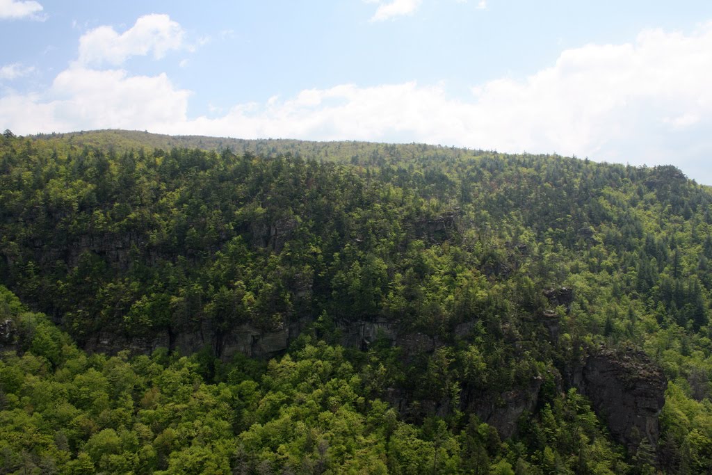
image - State of North Carolina in green. Yellow star marks location of Linville GorgeHidden deep the heart of the Pisgah National Forest in the western mountains of North Carolina, spectacular Linville Gorge can be rightfully be called the Grand Canyon of the East. Cut by the Linville River, it is 12 miles long and 2000 feet deep. This forested wilderness is bounded by Jonas Ridge on the east and Linville Mountain to the west. Numerous rock formations occur along Jonas Ridge following the canyon all the way to Shortoff Mountain at the southern end. This great wilderness area offers a feast of climbing opportunities.
Locator map (link Topozone.com)
Top of page

Photo by Wayne Busch - Jason Hale leads high on the last pitch of The Prow 5.4 at the AmphitheaterDescription
Linville Gorge offers mutli-pitch traditional climbing on some of the oldest exposed rock on the face of the earth, high quality granite with crystalline quartzite extrusions. The rock presents in large formations along the crest of Jonas Ridge and as long canyon walls once the ridge subsides. The cliff walls return again as Shortoff Mountain rises at the southern end of the gorge.
The most popular access point for Linville Gorge is Table Rock Mountain. Even so, it is a nine mile drive on gravel roads that can be in rough shape, then another 30 minutes to reach the nearest town of any size, Morganton. A second access point can be used for Shortoff Mountain by making a different approach from I-40 via Lake James - Nebo. Foot trails connect these two points.
Enlarge photo of Jason
Top of page

photo - picture 1 - sign with red cross through it, do not take this road.Directions
Approaches differ for Table Rock and Shortoff Mountain
Table Rock Parking Lot
From Morganton, North Carolina, drive north on SR 181 as it winds up into the mountains. In about 1/2 hour you will see a sign for the Table Rock Picnic Area (picture 1) directing you to a graded road on the left (Rose Mountain Road). If you take this route (don't), it is 13 miles on a rough road.
photo 2 - road branches to Gingercake Acres just after you crest the ridge.Most of us continue uphill on 181 a few more miles until we come to Gingercake Road road at "Gingercake Acres" (picture 2) at the top of the incline. There are signs here for both Gingercake Acres and Table Rock. Take Gingercake Road uphill (left), when it forks, continue on the higher road (left).
picture 3 - turn at sign leading up to Table Rock Picnic AreaIt will soon degrade into 8.5 miles of dirt and gravel as you leave the neighborhood. This road winds down through the forest from Gingercake Ridge and follows Jonas Ridge. It is normally passable by low clearance vehicles, cars, etc., though sharp turns can get deeply rutted. 4-wheel drive is not necessary. Watch for a sign for the turn off for Table Rock (picture 3), and follow the dirt road upwards.
picture 4 - The Outward Bound sign means you're getting close. You will pass the Outward Bound Center sign (picture 4) one mile from the top. The last section of road is paved due to its steepness, a series of tight switchbacks that wind up to the small 16 car parking lot at the top. The parking lot usually fills by the middle of the day on weekends, with parking along the road. This last section of road is gated, with the gates closed during the winter from January 1st - March 31st. You can park below the gate and hike up for winter climbing. There is also a foot trail from the Outward Bound Center.
Shortoff Mountain Trailhead
Leave I-40 at the Lake James / Nebo exit. Follow Harmony Grove Road to NC 126. Follow NC 126 for about 12 miles. Look for Wolf Pit Road on the left. Follow Wolf Pit road as far as you can. There is a small parking area at the end. This road becomes increasing rough as you climb. The last section may not be passable by cars and other low clearance vehicles, especially during rainy periods. Park here, then follow the trail until it intersects the Mountains-to-Sea-Trail (white blazes) and on to the top of the cliffs on Shortoff Mountain.
Top of page

Cliff Access
The Mountains-to-Sea-Trail (link to NCTS site) connects almost all of the features along Jonas Ridge and is easily accessed from the parking lot at Table Rock. Following it south 15 minutes brings you to the Chimneys. It continues all the way (6 miles) to Shortoff Mountain. Side trails lead to the North Carolina Wall and the Amphitheater.
image - large map showing layout of Linville Gorge. Shortoff mountain is not included.
Sections of some cliffs are periodically closed to climbing for the protection of nesting peregrine falcons. These closures most commonly affect Shortoff Mountain and The North Carolina Wall. They are in effect from January 15 - August 15. If it is determined the birds have abandoned a nest or moved, the area may be reopened.
Top of page

The Climbers Guide to North CarolinaSouthern RockGuidebooks
The Climbers Guide to North Carolina by Thomas Kelley. Included are descriptions of Sitting Bear, Hawksbill, Table Rock, Little Table Rock, Devils' Cellar, the North Carolina Wall, the Amphitheater, the Reggae Wall, and Shortoff Mountain.
Southern Rock by Chris Hall
Selected Climbs in North Carolina - Yon Lambert and Harrison Shull.
Top of page

Photo by Wayne Busch - East face of Table Rock, North CarolinaTable Rock Mountain - traditional climbing
(Enlarge photo of Table Rock) Table Rock Mountain is the hub of climbing activity in Linville Gorge. From the parking lot, trails lead to the summit of Table Rock (1 mile), Little Table Rock, The Devil's Cellar, and along the base of the cliffs on the south, east and north sides. Table Rock slopes up from the south end rising to about 400 ft. at the northern tip. The climbers you see from the parking lot are on the South End of Table Rock. The Mountains-to Sea-Trail passes on the back side of rock. From the summit, Hawksbill Mountainand Sitting Bear pillar can be seen to the north, The Chimney's and Shortoff Mountain to the south. Grandfather Mountain, Boone, Blowing Rock, Beech Mountain, the Blue Ridge Parkway are all visible from the summit.
To get to the South End of Table Rock, follow the summit trail leaving from the sign at the parking lot. Turn to the right at the first junction. You will pass a small nondescript trail that leads to the south face as you round the bend. Work your way up this small trail to emerge near Crackerjack 5.8 on the South End. There is a 4th class scramble to the summit nearby. You should be comfortable leading 5.8 to climb at the South End. Many more difficult routes can be done here.
Photo by Wayne Busch - Chase Crowson on My Route 5.6 on the NE corner of Table RockThe most popular face is the East Face. It has a fine collection of well protected moderate 2 and 3 pitch routes that are great to learn on or bring new climbers. Routes can be combined to access the summit. Continue around on the trail passing the base of some cliffs along the east face. The trail will work it's way to the first obvious (and most popular) climbing spot, the small clearing below Peek-a-boo 5.5 / Jim Dandy 5.4. You will pass a tree, step down, then the trail will break up and to the left passing through rhododendrons. There is a well used platform at the base of the climb. There are almost always a bunch of climbers here. You will also probably find a group a little further up the trail at The Cave Route 5.4 - This is the easiest route on Table Rock.
Rounding the corner from the East Face is the North End. The Lunch ledge is above, with a gully that leads down to the trail. The Cave Route is the last climb on the east face low, My Route 5.6 is above the Lunch Ledge. The trail gets steeper and encounters passes through rhododendrons to finally crest at the base of the North Ridge 5.6, and excellent climb, usually done in two pitches, but can be taken to the summit for bushwhacking types. (Enlarge photo of Chase)
Other great climbs here include Peek-a-boo 5.5, Jim Dandy 5.4, The Cave Route 5.4, Blood, Sweat, and Tears 5.7, Helmet Buttress 5.6, My route 5.5, Block route 5.5, K-Mart Special 5.5, Crackerjack 5.8, North Ridge 5.6, True Grit 5.8+, No Name 5.10, The Wasp 5.8, Rip Van Winkle 5.7, Second Stanza 5.9
Table Rock topo (link TopoZone.com)
Peek-a-boo 5.5, Jim Dandy 5.4, The Cave Route 5.4 (link to route descriptions)
Top of page

Photo by Wayne Busch - Jim Orafino stands at the top of the gully at Devil's Cellar. Devil's Cellar - top roping, traditional climbing
Rounding the north corner from the North End of Table Rock, you can continue back along the west side of the rock where you will come to The Devil's Cellar. It is more commonly accessed from the parking lot by taking the summit trail. About half way up the mountain, look for a side-trail (left) which branches off through rhododendrons. You emerge at the top of the chasm.
The Devil's Cellar is the chasm formed by a large buttress of rock that stands almost parallel to the steep west face of Table Rock. One end of the buttress runs in to Table Rock. A gully descends steeply to the bottom of the rock where a cave is found. The Devil's Cellar probably got it's name from the cave beneath the floor of the chasm.
This is a popular top-rope and rappelling area because it is easy to rig anchors to the trees and boulders atop the west buttress. There are also some traditional routes to be found on the walls of the Devil's Cellar and the north face of the buttress. Quiver 5.7 is a nice one.
Enlarge photo of the Devil's Cellar
Devil's Cellar - topo (link TopoZone.com)
Top of page

Photo by Wayne Busch - Little Table Rock is connected to Table Rock by a saddle. Seen from trail to Chimneys.Little Table Rock - traditional climbing
Little Table Rock juts out into Linville Gorge on the west side of Table Rock. It is connected by a narrow saddle which is accessed by a left branch off the summit trail. It is quite small compared to Table Rock and is mostly used for the few good campsites found here. Excellent views of the gorge can be seen from the west edge. There are some nice cliffs here and the guidebooks detail some climbs here, but I've never bothered.
Enlarge photo of Table Rocks
Little Table Rock topo - (link TopoZone.com)
Top of page

Photo by Wayne Buch - The ChimneysThe Chimneys - top roping
The Chimneys see at least as much visitation as Table Rock. A 15 minute hike south on the Shortoff Mountain Trail (Mountains-to-Sea-Trail) brings you along one of the narrowest portions of Jonas Ridge. Side trails lead to some great views looking back towards Table Rock from atop several outcroppings. A little Further and you came to Polaroid Point with excellent views into the Gorge. From here, drop sharply, then up over and through a narrow cut in the rocks. The Chimneys will be found on the left side of the point where the trail enters a rhododendron tunnel.
About 30 feet high with ways to scramble on top and rig anchors, the Chimneys are used almost constantly for groups of top rope climbers. Good views can be found on top.
Enlarge photo of the Chimneys
The Chimneys topo - (link TopoZone.com)
Top of page

The North Carolina Wall - traditional climbing
I have not had the opportunity to climb on the North Carolina Wall, you'll have to refer to the guidebooks. This area closes periodically for peregrine falcon nesting season January 15 - August 15. The NC wall lies within the Wilderness Area. Permanent anchors are prohibited, see Access Notes for details.
North Carolina Wall topo - (link TopoZone.com)
Peregrine Falcon Closure info - Note: The NC Wall has been added to the closed list (until July 1, 2004) due to the Forest Service’s efforts to protect the threatened plant Hudsonia montana (description). Photos of this rare plant can be found here .
See larger photo of the North Carolina Wall
Top of page

Photo by Wayne Busch - Stu Estes nears the top of The Mummy via the 5.7 Roof VariationThe Amphitheater. - traditional climbing
(Enlarge photo) The Amphitheater is a small canyon off the main walls of the gorge. It is bounded on the north by The North Carolina Wall. The Prow 5.4 climbs the corner formed. On the south side, the small canyon opens quickly to reveal the Mummy Buttress near the end of the wall. Plan on 45 minutes for approach and retreat, 1.5 hours of your day on the trail.
From the Table Rock parking area, follow the Shortoff Mountain Trail (Mountains-to-Sea-Trail) from through the camping area south toward Shortoff Mountain. There are a few secluded campsites along the trail (please don't use them - too much exotic plant life has been destroyed here). You pass by Polaroid Point, a flat rocky outcropping on your right, with panoramic views of the Gorge (great for sunsets). You will soon come to a narrow slot through a large rock, then pass by some large outcroppings on your left, The Chimneys. Pass through the damp tunnel of aromatic rhododendrons. Access to the North Carolina Wall is via an elusive trail(s) on the right.
Enlarge photo of Stu on The Mummy
Watch for a trail on the right when you've hiked for about 1/2 hour on the Shortoff Mountain trail. There is white quartz rock in the ground on the right side of the trail marking the right turn onto the Amphitheater trail. The pine tree on the left that has a white rock wedged in a crook has fallen over, as have most of the pines in the area. If you haven't made a right turn and the Shortoff Mountain Trail starts descending steadily into the gap, you've gone too far.
Once you turn right towards Linville Gorge and the Amphitheater, the trail will start a winding descent. The trail snakes through an area that is recovering from fires that burned through the gorge a couple of years ago. Almost all of the pine trees were weakened by fire and succumbed to beetle infestations the next year. Most have fallen. Underbrush is filling in, some of it very dense. After 10+ minutes you'll reach the top of the north wall of the Amphitheater. It is worth the effort to continue out onto the end of the north wall to survey the area below and identify climbs and landmarks. Be sure to look down from the end. There is a trail to a campsite atop The Prow on the right, about 1/3 of the way out the north wall.
To get to the floor of the Amphitheater, find the descent gully. It's on your left as you emerge onto the north wall, at the point where the trail leaves the woods. It's a steep, wet, muddy, slippery chute through a tangle of rhododendron, which will deposit you on the top of the sloping floor of the Amphitheater. Returning via this chute may not be feasible, depending on conditions, though erosion has made it a bit easier lately.
graphic - topo of Amphitheater showing trails and where the 3 most popular climbs are located.The three most popular climbs in the Amphitheater are The Mummy, The Daddy, and The Prow (link to route descriptions). The Mummy and the Daddy are located on the Mummy Buttress and are visible from the top of the North Wall of the Amphitheater. The Prow ascends the sloping face that runs from the bottom of the amphitheater to the top of the North Wall. I'll do my best to describe how to get to them and get back, but don't expect any verbal or written description to be adequate. It is a steep jungle down there, use proper footwear. On your first visit, it is best to bring someone familiar with the area.
Once you get to the bottom of the descent gully, cross the small wet area. There is sometimes a small waterfall here after a good rain, though it is most often a dry, rocky, fern-filled stream bed. Cross the rocky stream bed, and turn immediately right following trails descending along it. Don't be fooled into following the good path high along the South Wall once you cross the stream bed if you want to do one of the three popular routes. Follow the path of the water down instead.
Bushwhacking and scrambling along the most worn paths will lead you down the floor of the Amphitheater, crossing from north to south (right to left). You will reach a point where the trail strays away from what little remains of the stream bed, towards the south wall after you descend around a short rocky face with a shallow cave. If you want to climb The Prow, I suggest you break trail for the base of the North Wall from just below this boulder.
Mummy Buttress
Photo by Wayne Busch - The Mummy Buttress at the Amphitheater seen from atop The Prow.To access The Mummy and The Daddy, continue on the "trails" toward the south wall. Identify the Mummy Buttress on your left from the north wall before you descend, then whenever possible as you progress towards it's base. link - topo map on Mummy Buttress photo. Look for the large belay ledge the serves as the second belay ledge for The Mummy. Follow the crack down from the right end of this long ledge to find the start of the climb. It is hard to identify because the crack does not go all the way to the ground, but it will be found near the point where the trail first touches the wall on the Mummy Buttress. It is usually wet at the base with some moss on the climb. If you think you've found The Mummy, continue down from here a short distance to gain access to the base of The Daddy. The base of the Daddy is the most obvious because of all the traffic. The first pitch ascends a right corner to a pine tree atop a small buttress.
The return path from routes topping the Mummy Buttress runs along the top edge of the South Wall of the Amphitheater, with areas of sheer drops, thick brush, and confusing trails. Use caution. Find the trail on top of the Mummy Buttress, follow it to where the buttress attaches to the main wall. Cross here, follow the trail up and to the right, passing a line of 40 foot cliffs. Climb up the trail at the end of the cliffs, turn left, towards the Amphitheater. Follow the trail, always taking the higher trail whenever it meets another. You will circle around the top of the canyon, and find the trail out just beyond a large rock. Good luck!
Amphitheater topo - (link TopoZone.com)
The Mummy, The Daddy, and The Prow (link to route descriptions)
Enlarge photo of the Mummy Buttress
link - topo map on Mummy Buttress photo
Top of page

Photo by Wayne Busch - A potion of the wall south of the descent gully.Shortoff Mountain - traditional climbing
Shortoff Mountain is a good place to go to avoid the crowds. The rough approach road and the long hike into the wilderness area makes discourage the weekend crowds. The trail brings you in at the top of the cliff line after 45 min - 1 hour hiking uphill. There are some great campsites located here. The long faces have a good number of excellent multi-pitch traditional routes. The cliffs bottom is accessed via a gully in the middle of the face. 3rd class scrambling brings you onto the sloping floor, trails split north and south. Fires here in 2002 have altered the landscape considerably, trails may now be overgrown. Good routes here are the Maginot Line 5.7 and Dopey Duck 5.9
This area closes periodically for peregrine falcon nesting season January 15 - August 15. This areas lies within the Wilderness Area. Permanent anchors are prohibited, see Access Notes for details.
Enlarge photo of the cliff face
Shortoff Mountain topo - (link TopoZone.com)
Top of page

Photo by Wayne Busch - Hawksbill Mountain seen from atop Table RockHawksbill Mountain - traditional climbing
I've not had a chance to visit Hawksbill Mountain. The cliff faces can be seen from the top of Table Rock. You'll have to consult the guidebooks.
Hawksbill Mountain topo - (link TopoZone.com)
Top of page

Sitting Bear - traditional climbing
Sitting Bear is a small pillar with a handful of climbs on it. I have not visited.
Sitting Bear topo - (link TopoZone.com)
Top of page

image - logo- National Forest ServiceLand Manager:
Grandfather Ranger District
Pisgah National Forest
US Forest Service
109 E. Lawing Drive
Nebo, NC 28761
(828) 652-2144
National Forests in North Carolina http://www.cs.unca.edu/nfsnc/
Top of page

image - caduceus -  symbol of medicineEmergency Information:
Burke County Emergency Service 828-437-1911
NC Outward Bound Table Rock Base camp 828-437-6124
Grace Hospital, Morganton 828-438-2000
The telephone number for the Grandfather District Ranger's Office in Nebo, NC is 828-652-2144.
You are in Burke County.
Top of page

image - carabinerGear:
Light to medium rack adequate, no need for small or large extremes. The rock is usually featured enough that it takes gear well. I found larger hexes useful, rock takes nuts and tricams well. 50 meter ropes adequate, some double rope rappels. You can go pretty light if your just climbing at Table Rock, but if your planning a descent into the gorge, be prepared. Plan extra time for approaches and exits from Linville Gorge - they can often be more strenuous than the climbs. Be prepared for sudden weather (thunderstorms), darkness, cold, self rescue.
Top of page

Facilities:
The new bathrooms are a great improvementNo public water supply. There is a small spring located on the west side of Table Rock accessed by a trail that leads down from the saddle between Big and Little Table Rock. A plastic pipe delivers water fresh out of the rock. There are usually trickles of water to be found on the floor of the Amphitheater.
Primitive camping is permitted just beyond the parking lot in the wilderness area with permits, but not in the picnic area. (There appears to be no enforcement, you will see people camp amongst the picnic tables at times, please observe the rules). The further back you move, the less intrusions. Friday night sees many late arrivals, often youth-group van / bus loads. Theft / vandalism is rare. Table Rock has new bathroom facilities. There are trash cans, but they fill quickly - haul out your trash if possible. Pack out your recyclables.
There is a Chevron station with a small store (no beer) on 181 if you continue past Gingercake Acres (turn left if you're leaving Table Rock). They have many useful amenities like firewood, a grill, ice, hot pizza, sundries. You can buy beer in Spruce Pine. Nearest town is Linville or Morganton, about 45 minutes to 1 hour of driving. Climbing gear is available in Morganton and Blowing Rock, Boone.
Top of page

Photo by Jeff Braund - Chris Braund climbs near winter ice in the AmphitheaterSeasons:
Climbing at Linville Gorge favors warmer weather, but with summer climbing you should be prepared for the afternoon thunderstorms common to the season. Spring can be cold and wet, fall offers some of the best opportunities. Winter climbing is available on the occasionally warm day, but elevation and exposure combine to make Table Rock and Linville Gorge generally cold places. Combined with a long hike in when the road is gated, and only the most hearty brave the winter months. There are a few south facing climbs, and the east face of Table Rock warms with the morning sun and is often found in the lee of the wind, though you'll want to watch for ice fall December - March once the sun gets high. Temperatures will be several degrees lower than predicted for the surrounding cites due to the elevation. Fronts often approach unseen from the back side of Table Rock, conditions can change suddenly. Be vigilant.
Enlarge photo of ice in the Amphitheater

Top of page

Access Notes
9/18/07 - There is now a comprehensive website on the trails of Linville gorge www.linvillegorge.net which needs to be better known among climbers The site has an INTERACTIVE map, Data sheets on 39 trails not published on US Forest Service maps with 180 waypoints and a few GPX files. 70 trails are listed in the site INDEX and a hand drawn topo is available for each one plus a drop down menu that links to the relevant image on google earth.

Note that Burke Co had aerial digital photos made of the entire county and sold these to Google earth. This allows you to Zoom in on a person standing on a rock in the Linville River. Incredible!

Last year i petitioned the US Forest Service to reopen Rockjock trail. i sent 68 signatures and they responded by listing the trail in their Adopt a Trail program. Previously, they had informed me that they had NO plans to reopen Rockjock, so this petition changed their minds. This spring, the fires burned a good portion of the south end of that trail and the USFS assigned a spare fire crew of 21 guys to help re-establish a portion of this trail. Other volunteers have been few and far between . Work has been done at two of the four entrances and the midle section now needs attention. About 60-70% of the assignment has been completed.
This is a request for volunteers to help finish the Job.

Rockjock runs along the top of the Goldcoast wall on the west rim of the Gorge and skirts around several canyons, 6 waterfalls, and has side-trails out to many spectacular promnitories. It is directly opposite the NC Wall. Cliffs average 300-500ft.

The Agreement with the USFS only covered the Conly Cove to MCRT section of this trail--which was exactly the section shown on the USFS map. The map makers did not recognise the old trail which extends 1.6 miles futher south to Dobson knob road. If i ever finish the Assigned section, ill petiton AGAIN to contnue work to the Dobson knob road intersection.

In addition to Rockjock there are several craigs in Linville Gorge that remain lesser known to climbers. I hope the interest is sufficient among climbers to push for inclusion of the access trails to these craigs in the USFS Adopt-a-Trail program. Id like to see this program expanded and some of these trails could use regular maintenance.
i put a list of 11 such trails on the CCC message board. i guess i dont need to add: the once a year programs like Adopt-a Craig-day while MUCH APPRECIATED are but a drop in the bucket.

Hope you find the info here useful.

Bob Underwood


Table Rock and Linville Gorge are located in the Grandfather Ranger District of the Pisgah National Forest. Linville Gorge is a designated Wilderness Area and certain restrictions apply. Table Rock and The Chimneys are NOT within the Wilderness. Wilderness use standards are as follows: (from the Operating Plan)
image - Smokey the bear IV. Wilderness Use Standard: Wilderness Permits are required for overnight camping in Linville Gorge on weekends and holidays during the period May 1 through October 31. Permits are NOT required from Nov 1 through April 30, on week nights or for day use. Free permits may be obtained from the District Ranger's Office in Nebo, NC.
Permits are issued on a first come, first served basis beginning the first work day of the previous month. For example, permits for the month of June can be requested the first working day of May. The permits are used to limit overnight use to 50 people per night. When that maximum is reached, no more permits are issued for that nigh. Any one visitor or group may obtain a permit for only one weekend per month.
Standard: Length of stay in Linville Gorge is limited to three days and two nights per visit, year round.
Standard: Campfires are permitted in Linville Gorge
Standard: Rock climbing by Outfitter/Guide permit Holders is permitted Monday through Thursday only.
Standard: The Standards for Itineraries and Group Size are the same as for the Pisgah Ranger District.
V. Rock Climbing
Standard: As stated above, rock climbing by Outfitter/Guide Permit Holders is permitted Monday through Thursday in Linville Gorge Wilderness. However, Table Rock and The Chimneys are NOT in the wilderness.

Hey, wait a minute....

On visiting Table Rock, you may get confused as to camping. The Official line is that you must have a permit to camp within the Wilderness. The Wilderness begins just beyond the Picnic area. Camping is prohibited within the picnic area. You are asked to camp along the road in the National Forest if you do not have a permit to camp within the wilderness. You will see many campers in the woods just beyond the picnic area, technically the start of the wilderness area. Most people camp here without obtaining permits. I've not seen permitting enforced.
Peregrine Falcon Closure info
Top of page

Photo by Wayne Busch - Bouldering near the parking lot at Table  RockMiscellaneous
There are a few boulders near the parking lot, behind the big sign. Be careful when bushwhacking - vegetation grows to the edge of the cliffs. Sudden drop-offs are common. Outward Bound groups typically climb the Cave Route to the Lunch Ledge, then the Block Routeto the summit, but may be found almost anywhere. They also take groups to the Chimneys for top-roping. Most belay anchors are well maintained, the old bolts are being replaced with new Fixe anchors. Table Rock is a great place to build confidence leading multi-pitch moderate routes, and for partners to polish rope management skills.
The warmer weather brings out the biting flies and other blood suckers, particularly at dusk. DEET is marginally effective. Consider wearing long sleeves, long pants if the bugs become a nuisance on those last ascents of the day. They are rarely a problem in camp.
Enlarge photo of bouldering
Top of page

Links
Top of page

Linville Gorge Trip Reports
8/9/03 The One Climb Wonders Strike Again! Submitted by Wayne Busch - Bryan Hall and Wayne Busch are stuck in a rain induced rut of one climb days
12/03/00 Our Epic in the Linville Gorge Submitted by Eddie Medina - Eddie Medina, Jason Bowden, and Jeff Holman spend a day adventure climbing in the Amphithtater, then climb at Table Rock.
11/18/00 - Shortoff Mountain November 17-18, 2000 Submitted by The Buttinski's (Chris and Jeff Braund) - Chris and Jeff Braund climb Serendipitous and Little Corner on Shortoff Mountain
10/25/00 - North Carolina Favorites - Submitted by Wayne Busch - Wayne Busch and Stuart Estes visit three North Carolina climbing areas - Linville Gorge, Stone Mountain, and Looking Glass Rock.
7/3/00 - First Steps on Big Stone Submittted by Wayne Busch - Wayne introduces a few climbers to multi-pitch routes on Table Rock and The Amphitheater.
Summer '99 - Buttinski's Beat Big Wall Blues: Daddy Treats Brothers to Breathtaking Bivy Submittted by Jeff Braund - The brothers climb at Table Rock, hike down to the river, then spend a night bivied on The Daddy.
7/6/99 Wet and wild! Table Rock / Linville Gorge, North Carolina July 4th Trip Report Submitted by Jackie and Wayne Busch - A group of Flatliners meet for a weekend of climbing at Table Rock and the Amphitheater
5/8/99 Follow the New Leader - Submitted by Wayne Busch - Chase Crowson polishes his lead skills at Table Rock and The Amphitheaer with Chris Braund and Wayne Busch.
5/27/98 Table Rock / Linville Gorge, North Carolina Memorial Day Trip Report 5/22 - 5/25 Submitted by Wayne Busch - Flatliner group trip with climbs at Table Rock and The Amphitheater
9/1/95 Table Rock, Linville Gorge, NC Trip Report An Epic in Three Parts - Submitted by John Fisher - Hilarious lessons learned in Linville Gorge
Top of page

LINVILLE GORGE

LINVILLE GORGE
Get out here and climb people. This area is a gem, A WILD Gem!
Here is a link to the area from RC.Com
Click For Info


Monday, May 9, 2011

SC#7 Today

I hate to brag but today was a really good day of climbing at SC#7. Nephew got on some new rock for the first time their toady. I got in a couple of good clean leads and Kev got in one lead while protected by a top rope. The only really sad part of the day was missing the Power Couple at the crag. : ( But I did get the note on the windshield. Then rolled down to say Hello to Mr. Eagle and show Kev Eagle rock so I could watch him Drool, ya I know I have a different sense of humor. LOL only got about 5hr at the crag and it just made me hungry for a weekend of hard Rocking. Today was an on day today where everything clicked just right. LOVED IT.

Kev says that he wants to climb on his off weekend which will be everyone and he gets off work at 3pm now so he wants to climb local on those days. I think someone has the bug. He is supposed to be posting the trip report for today so stay posted. It is his punishment for making the old man lead all day. But it looks like I’m raising another new young'un which isn't very easy.


To Mike,

Brother, I just want to take a second here to tell give you a great big THANK YOU for all of the time that you have spent working with me over the last year. Thank you for the patience and understanding you have showed me as I walked the recovery road and getting over of injuries ... Brother I love you and always will for the time you have spent. You gave me my wings back, I will never forget what you have done for me and on the some note i will be passing on the climbing Knowles In the same manner that you took with me. It is can be a drag watching new people learn because they don’t have a system in place in their mind. You watch them struggle and hope for the best for them. I do really enjoy seeing the smile on someone’s face after they accomplish something they didn't think that they could do.


Well like i said Kev is going to be logging the trip report over hear in Pyro's World

Saturday, May 7, 2011

Would You climb on these?


I would not climb on these and if you saw how easy four of these pulled out you wouldn't either. Please look at what you’re clipping into folks. Just because it is placed in the rock doesn’t mean it is safe! Knowledge is power, never stop learning and never think that you know it all. I am by no means an expert at bolting and don't claim to be. I am learning, as I will be the rest of my life. Even I knew as soon as I saw this that it was an accident waiting to happen. Did I piss someone off? Yes. Did it keep someone from getting hurt? Probably. I have big shoulders and I will take what comes my way as fall out for my actions. Remember one other thing everyone. Every single person that ties into a rope or clips a bolt is a safety officer, If you see something that is unsafe make an on the spot correction to fix it. The life you save may well be your own.

Pyro

P.S.
As you can see I got a picture of the Troll at bear haven. From the look on its face it looks like it just got done feeding. If you see this troll DO NOT APPROACH, it senses fear and stupidity and may attack! Slowly lay your rack on the ground and back away from it. When you have enough distance RUN LIKE HELL!

Wednesday, May 4, 2011

Mystic Cave

Mystic Cave

A Beginners' Trip
Trip Report and photos
by Doug McCarty
On Saturday, February 16, 2002 grotto members Kevin Frick, Jason Thomas, Lisa Thomas, Don Humphrey, Ken Petrice, Bob Griffith, Mary Davis, and I along with new cavers, Phillip McCarty and Mark Randolph rendezvoused at McDonald's in Elkins and drove across the mountains to Mystic Cave. Before we got started, Kevin, who wasn't feeling very well that day, continued a Mon Grotto tradition by helping the property owner repair a stretch of fence. (This cave is on private property, which means permission must be obtained before going in. Mystic is closed from April 1st to September 15th.) The rest of us went ahead into the cave and headed downstream. We figured we'd have to be wet for a shorter period of time by going that way. Basically, going downstream is a pleasant sandy stroll through a nicely decorated stream passage with minimal amounts of crawling or climbing until you come to a short crawl with several deep rimstone bathtubs. From there you go through the fascinating but somewhat more narrow stream passage that leads to the Waterfall Room, where you climb down a 8-10 foot waterfall and go back to a point where the only option for continuing is a low crawl through very cold water toward the West Entrance.
We backtracked upstream toward the South Entrance and ran into Kevin close to the Junction Room. He had finished with the fence and had come looking for us. After eating lunch, we spent some meditative moments in the nicely decorated Formation Passage and then headed upstream. The water in the pools wasn't as deep as it could have been, but in one spot it came up almost to the waists of the shorter members of the party. We yipped our way through the cold water and eventually came to the Big Room, which also contains the pool at the base of the 3rd waterfall.
Several of us wanted to press on to the South Entrance. After a short rest, Jason, Lisa, Ken, Phillip, Mark and I continued upstream while Don, Kevin, Bob and Mary returned to the main entrance and went to visit with the property owner. After climbing up and over the 3rd waterfall, the formations disappear and the caving becomes somewhat harder, with narrower passage and more stoops and crawls. After about 4 or 5 hundred feet of passage, you reach a fairly high (maybe 20 feet) waterfall where you were going to have to climb again in order to continue. To get up there it was necessary to do some chimneying--something we would not do with beginners. Ken and Jason climbed up while the rest of us waited below. I had a 30' length of webbing in my pack, which we made into an etrier. Jason tied it to a convenient rock. I almost immediately had second thoughts. After some discussion, we decided that because the new folks lacked experience for a climb like that, it would be wiser to return to the Main Entrance. It was we more experienced cavers who were choosing to go into that more difficult area of the cave, and we were doing so because of our own desire to do so without taking into account the inexperience of the beginners. Luckily, we realized that before we got them up there in the tight passage that awaited us at the top of the falls. Because he was already up there, Kenny went ahead and crawled the final 200 or so feet it took to reach the South Entrance. Jason climbed back down and went with the rest of us back downstream. Lesson learned: When you're on a beginners' trip, don't forget the beginners.


Kenny


Bob


Mary


Phillip and Mark doing a 8 foot or so climb down the 6th Waterfall into the Waterfall Room


Phillip wading in the Water


Don and Kevin


In the Big Room

Back: Mark, Mary, Bob, Kenny, Jason

Front: Don, Kevin, Phillip

Bowden Cave

Bowden Cave System

Randolph County, West Virginia

Ray Garton and Dan Nigh

Karst Kaver 5(1)

January-March 1971

http://www.caves.org/grotto/mongrotto/bowden.htm


History. The Bowden Cave System is located 10 miles east of Elkins on US Rt. 33. The entrance is beside the road and in an old abandoned quarry. The main entrance and parts of the Front Section of the cave are owned by John Knutti. The remaining six entrances and portions of the cave are on Monongahela National Forest lands.

According to the owner, the original cave entrance was at river level (Shavers Fork) but collapsed and was filled in when US Rt. 33 was built in the early 50's. The original entrance was a dry stoopway and a large stream resurged just below the entrance. At present the resurgence is much where it always was and water merely flows out from the rock fill. There was a short down slope just inside the entrance, and then the passage leveled out and continued as a walkway. According to Mr. Knutti, the passage was pretty large with a couple of rooms along it. One room he said was almost a perfect square about 50 feet on a side. This was also the best decorated section of the known cave. This little known section came into the now-called Big Room at the downstream end. Best reports indicate that this section is now in a state of further collapse and flooding. A short swim is required now to get to this section and it takes very little rainfall to flood the passage. The owner tells of a time when he ventured to the old section and found a single rock weighing about 20 pounds holding up the road. At one time the owner had planned to commercialize the front sections, and thus dug many trenches, built stone walls, and a bridge to make the entrance easier.

Systematic exploration did not begin until the early 60's and then no map was made. Sometime during 1967 the Monongahela Grotto became interested an made a sketch map of the first 2000 feet of cave. Then during the first three months of 1968, D.D. Williamson and party mapped over 5000 feet in the back section of the cave. Later the same year members of the D.C. Grotto mapped the section the Monongahela Grotto had sketched earlier. There was then over a mile of mapped cave, much more than described by W.E. Davies a decade earlier. The monongahela Grotto again picked up the work in mid-1968 and has been at it ever since, mapping and re-mapping to an extent of over 22,000 feet with better than 10,000 feet of that being virgin.


Geology The Bowden Cave System is developed pretty much through the extent of the Greenbrier Limestone in the Gaspar and Bethel portions of the Union series. The cave also lies near the base of the North Potomac (Georges Creek) Syncline. The vertical extent of the cave is 170 feet. The dip of the limestone is 10 degrees to the east and the strike is to the north. The cave trends north and many complex passage systems are developed in the rear portions of the cave. The rear parts of the cave, being near the top of the limestone, are filled with many shaley impurity layers possibly giving rise to the development of several entrances so close together. It is interesting that even though there are five entrances within a 100 yard radius, the interconnecting passages are developed in a complex manner. Thus one must travel many times the distance underground from entrance to entrance as compared to only a couple hundred feet on the surface. This complex maze of passages has made mapping and plotting difficult. Subsequently, maps of these sections are hard to interpret.

The number of domes and domepits are nothing less than astonishing. They range from 6 to 50 feet high with proportions to match. Some are cut through many impurity layers, for example the Shower Room is 50 feet high and 15 feet in diameter; every few inches is a layer of soft brittle shaley limestone. There are at least 20 domes in the M.G. Section, and most display smooth walls 50% of their height. These smooth walled domes make an ideal place to study cross bedding, and many interesting patterns may be seen. The domes of the Windy and Bear Heaven Sections by and large have passages at the top of them and they too display impurity layers.

As can be seen from the map, the entire northern and western parts of the cave are complex mazes with few repeating patterns of joint control. The eastern portion is pretty much straight and uniform, which is probably due to it being down dip.

There are not extensive vertical pits in the cave. The largest would be the 50 foot drop from the top of the Cathedral room in Bear Heaven. There are however several lesser pits between 15 and 20 feet which require rigging of ladders or scaling poles.

A number of faults can be seen in the quarry face as well as in the cave, but there is no evidence that faulting has taken place since the cave's development.

Fossils in the cave are few and far between. The only obvious ones are crinoid stems.


Hydrology The true hydrology of the cave has never been established due largely to lack of time and complexity of the system. The main source of water seems to be the left hand fork of Bickle Run which is a stream of 1000-1500 gallons per minute. The stream sinks just above and often into the Bickle Run Entrance, the northern most entrance. The stream again sinks in Bear Heaven and is not seen until it bubbles up in a deep pool some 1000 feet away in the back section. From here it ceases tricks and flows out of the cave at river level. Attempts have been made to dye trace the stream, but all have failed thus far.

The water levels in Bickle Run Cave vary quite a bit and not necessarily with rainfall. This may be due to the clogging of passages by debris but it seems more likely that the northern sections of the cave are undergoing drastic and rapid hydrological change.

There are a number of tributaries to the main stream and two seemingly independent streams. To discuss the independent streams first, they are relatively small, only a few tens of gallons per minute, and sometimes dry. The most unusual one is in the 69 Cave Entrance. When it 's running low it flows southwest to an unknown section of the cave. When it is running a little high it flows in the usual southwest direction, but also a branch flows east into Bear Heaven. The other stream is at a point in the back section called the T, and it flows southwest and thus should intersect with the main stream, but as far as is known this is not the case. It is doubtful if the meanderings of these streams will ever be known because the passages in which they flow are too small to be traversed. There are no less than five other tributaries to the main stream. The main one is nearly as large as the main stream flowing into the Bickle Run Entrance. The right hand fork of Bickle Run flows over a waterfall and sinks into Bowden at the Second Entrance. No passage is traversable at this point and the water makes its way down through a hundred feet of rocks and fine breakdown. By the time it reaches the main stream it has branched several times and flows out into the cave passage at several points along a high fissure just beyond the junction of the Second Entrance passage and Battery Room.

Perhaps the tributary of greatest interest is the stream falling from the top of the Cathedral Room in Bear Heaven. Evidence indicates this stream to be slightly higher in elevation than where Bickle Run sinks on the surface. It is 50 feet to the top of the room, and attempts to reach it have failed so no one knows where the stream might lead. From below the passage looks to be 10 feet wide and 4 feet high. The stream covers the entire width of the passage but is shallow, perhaps less than an inch in most places. During dynamiting operations to connect Bear Heaven to Bowden, it was noted that the smoke was sucked up this passage, so it must go somewhere. The only evidence of the origin of the stream is a fairly large stream sinking in the next hollow up from Bear Heaven. This stream is nearly 200 feet higher than Bear Heaven and some 1500 feet away. However, an entrance needs to be dug and thus no one attempted to seek a connection. Only one dye test was attempted and it failed.

A stream of about 30-50 gallons per minute flows out of the Agony from the M.G. Section. The stream branches 200 feet along the Agony and the western branch is low and accounts for only 1/5 of the total stream. It probably originates from a dome. The northwest branch which leads to the M.G. Section flows where it can be seen, almost the entire length of the trunk passage in the M.G. Section. A couple of small domes feed along the way but the bulk of the water collects from a dome which can be seen but is too small to be entered.

A small stream, inches wide and deep, flows through the Windy Section and its origin is unknown but is expected to originate from a dripping dome

In conclusion, three of the tributaries are fed by domes because they do not rise rapidly when it rains and this is due to the time required for water to filter down from the surface of the dome. The two larger streams are fed by direct surface streams and they rise and muddy rapidly with rain. It is interesting to note that all of the water which flows into and through the system originates somehow or other from other resurgences further up Bickle Hollow.


Biology and Paleontology Few systemic biological studies have been undertaken in the Bowden Cave System. The first was probably done by a group of students from West Virginia Wesleyan College in 1967, but as far as is known none of their work has ever been published. At the same time the D.C. Grotto was mapping, they did some bat banding.

The most significant discovery was made by the Monongahela Grotto. On January 16, 1971, a mastodon tooth was found in the M.G. Section of the cave. It was positively identified by Dr. John E. Guilday, Associate Curator of Vertebrate Fossils at the Carnegie Museum. The tooth is 3x3 inches and about two inches thick. About six inches of the length had been broken off when it was found. In appearance the tooth is characterized by a white bone structure on the underside (root side) and a white and brown enamel 0.25inch thick. A few deposits of dripstone are on the tooth. The tooth was found unburied and lying on a rock in a small breakdown pile. Apparently it had been washed or had filtered in via a fissure leading to the surface. Knowing the age of the tooth to be 10,000 to 15,000 years it is most likely it filtered in via the fissure since it has probably been much longer than 15,000 years since a stream flowed in that part of the cave. Along with the tooth an odd shaped object was found which looked like a bone, but was discarded until a later date.

On March 6, 1971, another trip was made to where the tooth was found. In a passage some 200 feet from the position of the tooth, two bones were uncovered; each measuring 11 inches long. They were both very brittle and looked of similar age as the tooth. One fragment was broken as if it was uncovered and the other showed a definite curvature such as a section of a large rib. These bones along with the object thought to be a bone found near the tooth were brought from the cave. It was impossible to get the bones out of this section of the cave intact. Only the odd shaped structure found earlier came out in one piece. All of the specimens were sent to Dr. Guilday for identification.

Two species of bats have been observed: the little brown bat and a larger brown bat. No colonial bats have been observed and hibernation habitats within the cave seem to change from time to time. Once hibernating bats were observed hanging from one another in a column 8 bats long. Only one bat was attached to the wall. From observation of hibernating groups it is doubtful if the bat population is much over 1000. Another interesting feature of the cave is a white cotton like fungus which grows on the old wooden planks and bridge in the cave's big room. Sometimes the fungus has an orangey color. Also in connection with the fungus are mushrooms with long slender stems and heads 0.5 inch in diameter.

A number of varieties of cave crickets have been observed along with worms, centipedes and millipedes, also crayfish and minnows (probably washed in) but none have been identified.

All of the entrances with the exception of the main entrance have great numbers of large black hairy spiders living within a short distance of the entrance. Webs are also numerous and laden with moisture. The 69 Cave Hillside Entrance is particularly populated with spiders.

Rats are common to all entrances but are seldom seen. Most live relatively near the entrances, but some may be found 500 feet beyond the main entrance and have often been observed while camping near the register.


Speleothems. Speleothems are few and far between and note will only be made of the particular area of the cave in which they are found. Rimstone dams may be found at the downstream end of the big room. By following the stream upstream, a number of oddly shaped stalagmites and stalactites may be seen. There are no speleothemsin the Back Section of the cave to speak of and none of the other entrances has much to offer.

The M.G. Section has a number of speleothems. Formation Corner is filled with very old stalactites, stalagmites and columns ranging from a foot to six feet high (Note: See a photo of Formation Corner here). Most are covered with a later growth of cave coral and are muddy brown in color. Although hard to find, the Formation Room of the MG Section is worth a look. It is a small room 20x15 but filled with all types of speleothems. Many delicate soda straws and stalactites with soda straws for a base and greatly enlarged ends may be seen. There is a nicely shaped six foot column and a few scattered helictites. A walking passage leading grom the room is lined with coral and small white stagmites. There are a number of other isolated speleothems in the M.G. Section. Most of them are near the High Room.

Although the cave is lacking in speleothems, it is not lacking in a variety of other features. Domes and domepits are of particular interest. The M.G. Section has the most to offer in this respect. The Hall of High Domes is a room of five interconnecting domes 30-50feet high. The dripping water has carved out razor sharp spines in some of the breakdown blocks. There is a crawlway passage near the tip of the highest dome and the view from above is breathtaking. Mary Ellen's and Zipper's Domes are ideally shaped twin domes 45 feet high and still slightly active. There are dozens of other domes in the M.G. Section and many have smooth walls and cross-bedding is clearly visible. The Shower Room in the Front Section and the Cathedral Room in Bear Heaven are spectacular and quite active. They are 40 and 50 feet high and the Cathedral Room is 25 feet in diameter. In wet weather the waterfall is breathtaking.

Another interesting feature of the cave is its pendants. One trangular shaped pendant 3 feet long hangs in a fissure 1000 feet into the cave. Midway through the Back Section is the Pendant Room--100 feet long, 50 feet wide and 20 feet high. Huge and irregularly shaped pendants perhaps weighing a ton hang from the ceiling. There are many lesser pendants along the passage leading north out of the room. The Pendant Maze in the M.G. Section is a maze of passages about 400 feet in extent. The passages are actually formed by pendants hanging to the floor. Passages are mainly stoop and crawlways.

One hundred feet beyond the Cathedral Room in Bear Heaven is a natural bridge spanning the passage. The bridge is six feet wide and six feet high.


General Description The main entrance to Bowden is 20 feet wide and 15 feet highbut is reduced to a crawl within 50 feet. The crawl is 15-20 feet wide and a trench has been cut through the fill to make entry easier. One hundred feet inside the entrance is a low narrow crawl trending west for an unknown distance behind the quarry face. Just before this crawl are remnants of a gate and 50 feet beyond is the Big Room--250 feet long, 75 feet wide, and 7-15 feet high. The room is free of breakdown and the main stream flows along the east wall and under US Rt. 33 and into Shavers Fork.

Halfway along the west side of the room is a crawl nest to the ceiling in a pile of rocks, the Cat Crawl, less than 2 feet high and 3 feet wide, leads 65 feet to a small room. Just before the room is a small hole leading to the Agony, 400 feet of mostly belly crawl to the M.G. Section. A stream flows through the crawl and need only be entered the last 75 feet to the M.G. Section. At the end of the crawl is a low mud bank leading to the Ecstasy and register. A low broad crawl leads south from the room and a wide walkway-stoopway leads north 200 feet along the stream to the First Big Room. The room is filled with large breakdown blocks and is 100 feet long, 30 feet wide and 6-40 feet high. The height of the room cuts through three levels. At the level which the room is entered a wide walkway trends north for 400 feet to the Second Big Room. Entry to the middle level may be gained here.

Infinity Crawl starts at the south end of the First Big Room on the middle level. The crawl has been pushed 635 feet to where a rock blocks the passage some 50 feet in back of the quarry. At several points along the crawl there are openings leading perhaps to lower levels. From the north side of the First Big Room the middle level trends north for 100 feet to a shallow pit. At the base of the pit is the lower level. Across the pit the middle level continues as a walkway-stoopway for 200 feet to a once large dome. It was perhaps 60 feet high and 30 feet in diameter at one time. Just before the pit described earlier is reached, a sloping walkway trends west to the upper level. Fifty feet along the passage is a low crawl trending west then north then west again to the section where the mastodon tooth and bones were found. Most of the passages in this section are crawl and stoopways. Many leads remain to be checked.

The High Room is the first noteworthy point encountered in the upper level. There are a few scattered speleothems in and about the room. The passage on the east wall of the room leads back down to the Infinity Crawl and a small dome room. Two passages trend west from the room. The one farthest north, Bickel Hollow Crawlway, goes west 200 feet passing through many smooth walled domes. At this point things become a little mazey and passages become smaller. The main trend switches to south then east and 200 feet of alternating crawl and walkway leads to the top of the highest dome in the Hall of the High Domes. The Hall of the High Domes is entered via the other passage in the High Room. Along the passage leading to the top of the dome is a stoopway trending southwest to Mary Ellen's Dome. A crawl trends south then southwest from the dome to the Formation Room and Mystery Domepit--a yet undescended and unclimbed domepit with passages at the base and top.

Beginning at the Second Big Room and moving into the middle level Formation Corner is encountered, then the Pendent Maze and Zipper's Dome, which is only a few feet from the large breakdown filled dome described earlier. There are still virgin sections of the MG Section waiting to be discovered. The M.G. Section has something to offer every caver.

Back in the main section of Bowden the main stream passage trends north 700 feet from the Big Room where it intersects the main trunk channel coming from the Big Room. The stream passage is a walk and stoopway while the trunk channel is 20 feet wide and 15 feet high. At the point where the two passages join, the trend of the cave changes to west for 500 feet (remaining a large walkway) to the Breakdown Room. Just as the room is entered a passage five feet off the floor leads to the Shower Room. Halfway through the Breakdown Room a low narrow crawl leads to the Water Course. Two Hundred feet before the Breakdown Room the main stream issues from a fissure 7 feet high and three feet wide. The fissure passage is called the Water Course and averages that size for 400 feet, then opens up into the much larger Back Section.

At the end of the Water Course is a small room filled with breakdown. The way through the breakdown is well-marked by vandals. The passage through the breakdown is small, but within 100 feet it opens up into a large stoopway. Four hund4red feet beyond the room this passage is a large walkway and a path across as breakdown covered room leads west and into an upper level. On this level is a nicely decorated room with one passage leading south and back into the main passage.

Just beyond the Formation Room is the Pendant Room--100 feet long, 50 feet wide, and 20 feet high. The room has very large pendants hanging from the ceiling. One large crawl leads west then north from the room. The crawl may be traversed for 400 feet to where it intersects with the main passage coming from the Pendant Room. Halfway along the crawl is another small crawl trending west and leading to the A-maze-ing Section. This section is an alternation of stoop and crawlways arranged in a joint controlled maze. Over 1200 feet have been explored and mapped and still leads remain to be checked. The main passage coming from the Pendant Room is 20 feet wide and 15 feet high for 300 feet where it enters the second largest room in the cave. The room is 200 feet long, 50 feet wide and 15-30 feet high. The main stream flows through the middle of the room and sinks at the south end. There is a rock in the stream resembling an overturned boat; the rib work even seems to be visible. There are several side leads near the room; one called the "T" is 150 feet before the room It goes for several hundred feet and pinches out near an unexplored stream. Most of the other side leads near the room are short interconnecting crawls.

The main passage beyond the room becomes a little smaller and confined to the stream passage. Three hundred feet beyond the room is a small room called the Battery Room. This is where the Second Entrance intersects the main cave passage. The Second Entrance is 3000 feet up Bickle Hollow and one hundred yards up the right hand fork of Bickle Run. The entrance is a crawl in a large sink.. A large stream insurges at the base of the sink. Just inside the entrance is a six foot drop then a 22 foot deep fissure. A passage runs across the top of the fissure for 50 feet to a small room. A 15 foot drop in this room leads to another small room and dome. There is another short drop in this room. At the base of this drop a recently fallen rock blocks the passage, , however the rock could be removed if a rope were tied to it and two or three men pulled from above. Beyond the rock is another drop and at the base is a small crawl leading to the Battery Room. The total depth of the entrance is 100 feet.

Continuing upstream from the Battery Room the main passage is a high fissure for 100 feet and a crawl in some places. Apparently, this fissure is part of the Second Entrance and the stream that sinks on the surface flows out into the main passage at several points along the fissure. Beyond the fissure is a low wide stream passage and a 10x10 foot walkway for 100 feet to the start of the Back Section maze. The maze begins at a large room and the main stream passage is off to the east side of the room. Perhaps a dozen passages lead out of the room in all directions. Most are walkway but are reduced to crawls within 200 feet.

So as not to become lost on the way to the Windy Section it is best to follow the main stream passage. It is 10-16 feet wide and 3-10 feet high and trends north for about 300 feet. Several crawlways intersect the passage but are only parts of the maze. The stream then makes a sharp turn to the west and cannot be followed, but a broad crawl trends northeast for 100 feet. At this point the crawl branches. The branch to the west continues with much the same for 200 feet to a small room with the main stream bubbling up out of the floor. Beyond the room is more maze. The other branch of the crawl trends north and is under a low ledge, if a low ledge can be imagined in a low crawl. The crawl is inches high and 15 feet wide for 100 feet then becomes a little higher and turns to the northwest for 200 feet where a wide but low room is encountered. Three passages lead from this room, one to the south is wide and lower than the previous. If it were pushed far it would intersect the maze. A low narrow crawl leads west from the room and it too intersects the maze. The passage to the north is four feet high and six feet wide for 100 feet to where it becomes lower and branches at STA 16. The west branch leads to the Third Entrance.

The Third Entrance is located 3300 feet up Bickle Run and is an obscure hole just below the road. Just inside the entrance is a six foot drop, and a walkway leads 75 feet to a canyon. 50 feet long. The drops may be bypassed by a step-across along the edge of the drops. After stepping across, an 8 foot drop and a stoopway at the base run for 50 feet along the top of the canyon to another drop. At this drop is another step-across which leads to a low broad crawl. The crawl trends west for 75 feet to a football shaped room 50 feet long, 20 feet wide and 8-15 feet high. The drop at the step-across is climbable and a narrow fissure leads from the base of the drop to a room 50 feet wide and 10 feet wide, followed by a room of similar size. A low broad crawl trends south from the second room 100 feet to STA 16.

The other passage at STA 16 is a low wide crawl trending northeast for 200 feet, then northwest for 100 feet where it branches. The branch to the north leads to a small circular room. Halfway up the wall is the Chocolate Crawl and 100 feet beyond the Mystery Dome. There is a scaling pole at the dome and the passage at the top goes 50 feet to a dead end. The other branch continues as a crawl for 100 feet to a fissure with a dome at the top. A small crawl leads out of the top of the 8 foot high dome for 30 feet to where one half stick of dynamite was used to pulverize a rock blocking the passage connecting Bear Heaven to Bowden.

Bear Heaven is located 3500 feet up the left fork of Bickle Run and 100 yards south of a small waterfall. The entrance is on the east bank and is a 10 foot wide four foot high opening into a large room. Two large high walkway passages parallel each other for 100 yards then turn toward each other and connect. Along the south wall of the entrance room is a shallow pit just below a small dome. At the base of the pit is a very low crawl trending west for 30 feet to a 15 foot deep 9 inch wide fissure. At the base (known as Paul's Section) is a small low room with two passages trending southwest. The one nearest the base of the fissure goes 75 feet and is reduced to a pinch in a breakdown pile. A room can be seen and a large waterfall can be heard through a crack 3 inches high and 12 inches long. The other crawl is a foot high and several wide. Thirty feet along the crawl a fissure in the floor 2 feet deep, 4 feet long and 5-7 inches wide leads to 69 Cave.

69 Cave is located 150 feet west of Bear Heaven and on the other side of Bickel Run. There are two entrances. A collapsed pit leads 50 feet to a narrow fissure 12 feet deep. At the base is a crawl for 20 feet where the passage branches. The branch to the south leads 15 feet to the base of a canyon. The top of the canyon may be reached via the Hillside Entrance only 20 feet away from the Pit Entrance. The other branch twists and turns for 30 feet to a shallow pit. A small crawl at the top of the pit leads 10 feet to a small room. A passage trends north and up a steep breakdown slope for 20 feet then continues 50 feet ending in a small unstable room. Another passage trends east from the room for 30 feet as a crawl where the fissure leading to Paul's Section and Bear Heaven is encountered.

A shallow pit in the breakdown along the north wall of the entrance room of Bear Heaven leads to a stream passage trending east for 75 feet where it intersects the main north passage coming from the entrance room and west for 50 feet to a large waterfall. The falls has a total drop of 43 feet and a low stream crawl leads to the room seen through the pinch in Paul's Section. To the north a short crawl leads to a fissure in the floor trending northwest to Bickle Run Entrance.

The Bickle Run Entrance is located 200 feet north of Bear Heaven and on the west bank of Bickle Run. The entrance is a triangular pit 7 feet deep. There is a large walkway at the base for 20 feet to a 22 foot deep, 35 foot high domepit. A stream normally flows over the pit. At the base is a walkway fissure trending east for 50 feet where it is reduced to a very narrow fissure crawl going on to Bear Haven.

The North passage from the entrance room of Bear Heaven slopes steeply down over breakdown for 75 feet where it levels out. A hole in the ceiling leads to the Cathedral Room, 50 feet high and 25 feet in diameter. A large passage can be seen at the top but has not been reached. The passage from the room is 30 feet high and 6-15 feet wide. Seventy five feet from the room is a nicely shaped natural bridge spanning the passage. Just beyond the bridge the passage turns is a hole in the ceiling leading to the Gofours Nightmare. From here a narrow stoopway leads southeast 75 feet to a 17 foot pit. The room at the base is 25 feet high, 10 feet wide and 50 feet long. A low crawl leads out of the room for 20 feet where the one half stick of dynamite was used to make the connection to Bowden.


This photo was taken at the Bear Heaven Entrance of Bowden about 30 years after this article was written. From left to right: Bob Griffith, Doug McCarty, Jason Thomas, Rich Finley, John Barth

Bear Haven A wonderful place for Bouldering

There is no longer any bolted protection at this wonderful bouldering area. The Rock Troll seems to have righted a potentially deadly wrong by eating all that pesky metal so poorly placed here. We do need climbers that are responsible and aware of the impact that they create. We DO NOT need climber's hurt or killed due to some poorly placed bolts. It would only take one person hurt due to bolted protection pulling out of the rock to ruin it for everyone.
Last November I went online and reached out to different climbing clubs from DC to New River Gorge trying to find someone who knew anything about who placed these bolts and asking them to fix or remove them before someone got killed. After an initial flurry of emails giving leads on who may have done this the info dried up. I think that one of two things happened,
1. It was someone moving through the area and decided to grace us with their ineptitude and stupidity.
2. It was a group that after being called on their piss poor bolting has decided to keep their mouth shut as to not look like the inept excuse for climbers that they are.
Either way these poor excuses of "Protection" have been removed. I wait with abated breath to see if they reappear in the future...
Bear Haven lies on a spur ridge high on Shavers Mountain outside Elkins. It can be pretty cool on summer nights. I can only imagine what the year-round campground is like around dark in mid-January. Most tent campers will head up this way during the warmer months to enjoy a small, quiet campground tucked away on the back side of the Otter Creek Wilderness.
The Otter Creek drainage forms the centerpiece of this preserved national forest land. Mountain ridges are the borders, where spruce stands and bogs hold strong. Lower in the wilderness are tangles of rhododendron over which grow northern hardwood species such as cherry and yellow birch. This area was once logged-any trails follow old railroad grades. In other areas, apple trees mark home sites long since abandoned. On the edge of the wilderness, Bear Heaven campground awaits your arrival.
What does this mean for you? It means a great place to get into the heart of natural West Virginia, where the woods are king once again. Then, you can return to your ridge top camp and reflect on the day's observations. One of those observations will be what a fitting campground to be adjacent to the Otter Creek Wilderness. Another observation might literally be an observation from atop the jumbled rock outcrop near the campground picnic area where you can look south over a sea of wooded ridges.
Leave the spur road off Stuart Memorial Drive and enter Bear Haven Recreation Area. To your right is the picnic area and rock outcrop. This spur ridge is level by mountain standards and covered in a northern hardwood forest dominated by beech and cherry trees. The canopy thickens in summer, with an understory of sugar maple and striped maple. Come winter, you can better see the numerous gray boulders strewn about the campground like children’s' toy blocks tossed around a room.
Three sites occupy the main road. Wood log borders keep campers where they ought to be. The campsites are very dispersed and large, even though this spur ridge is narrow. There are winter views into the woods below. Some less-than-level sites have tent pads.
Enter a five-campsite loop. Campsites #4 and #5, the two prettiest and most used, are integrated into the boulder-dominated landscape. Swing around the loop and pass the final few campsites. This small campground has only eight units, offering the good and bad of small campgrounds: intimate, yet possibly packed with campers, as well. Bear Haven fills during mid-summer weekends and traditional summer holidays. Other than that you should have no problem getting a campsite.

Saturday, April 30, 2011

A lesson in Navigation

Chapter Two

Staying Found


            Just as cold is actually the lack of heat, and as what we know as darkness is no more then the absence of light, so is getting lost an entirely negative state of affairs.  We become lost not because of anything we do, but because of what we leave undone.

            It is when we realize this that all the mysteries imputed to the procedure of finding one’s way through wilderness vanish, and in their place appears a positive  and ever intriguing problem of distance and angles.  For there is just one method to keep from getting lost, and that is to stay found.

            We stay found by knowing approximately where we are every moment, and this is not as complicated as it may seem, for any one of us can keep track of his whereabouts by means of a map, compass, and pencil.  Every ten of fifteen minutes, or whenever direction is changed, we should bring our map up to date.  Suppose we do not have a map?  Then we draw one as we go.

            The sagest old sourdough uses the same system whether he realizes it or not.  His map is just in his mind that is all.  Sun, stars, prevailing winds, vegetation, landmarks, and numerous other natural factors may be the veteran woodsman’s compass under; it should be well noted, favorable conditions.

            By timing ourselves or by otherwise measuring distances, and by making either a written or mental record of all the angles of travel, we get so that we can always tell just about how far away in what direction lies the spot from which we started.


What about following streams?

The more you and I learn about the wilderness, the more poignantly do we realize that no way of thinking or doing, however venerable, can be trusted without proof.  Although innumerable widely accepted opinions sound reasonable enough in theory, too many of these have the often fatal tendency of not working out in practice.

            An example is the counsel that following a stream downhill will eventually lead us back to civilization.  In well settled country it will, usually, if we take the sometimes, unmentioned precaution of keeping to the higher sides of any swamps.  In a reasonably populated area it will, ordinarily, if we keep going long enough through comparatively heavy growth and downfall which characterize watercourses.

            In real wilderness, particularly under the stresses imposed by emergency conditions either real or imagined, following a strange stream with any assurance is something else entirely.

            Suppose we manage to detour impassable gorges?  Suppose we are successful in circumventing morasses and marsh lands?  Suppose we can continue to twist and batter our way perhaps a dozen exhausting miles through pine and willow for every mile gained?  The flow may very well end in an isolated pond even farther back of beyond.


Who should carry a compass?

            Even the most experienced woodsman would do well to carry a compass (along with matches).  For instance, you and I are on Gaspe Peninsula knoll.  The sun has set.  We glimpse smoke curling up a mile away from the tents where all day Vena has had a mulligan simmering.  Heading directly there in the straightest possible line can mean the difference between arriving easily and safely during the remaining daylight and taking the needless chance of getting a dead branch in the eye.

            So we sight over the compass.  The tents lie exactly south by the needle.  Ounce we’ve dropped down to the flat, we’re in small thick spruce so dense that some of the time we have to get down and crawl.  We can not see far enough ahead to line up a straight route without a lot of time consuming care, but checking the compass occasionally assures us that we are heading most directly for camp.

            Or we’re on the side of the continent, atop a Yukon mountain.  Clouds swirl about us, blotting out all landmarks.  Camp, we’ve ascertained during the climb, lies east down what is the only safe slope.  The weather is thick by now.  Which way is east?  If we have a compass, we neither have to wait on this exposed peak for the atmosphere to clear, nor need we risk any undue or unnecessary dangerous scrambling.


How a tenderfoot can be superior to natives.

            What is often regarded as a natural sense of direction is instead almost always the result of either,

(1)   acquired skill that seems so effortless as to appear instinctive, or

(2)   Familiarity with the surroundings.


The man who lives on the edge of a clearing can be expected to become as closely acquainted with the woods surrounding as the hood rat with the streets of his own neighborhood.  The ruralist in a strange countryside and the urbanite in an unfamiliar metropolis will, is depending solely on familiarity, both become lost.

      Knowledge of locality becomes less and less valuable the further we travel, for few of us can make a very long journey without leaving the region we know.  This is a major reason why explorers the world over have repeatedly plagued by the desertions of aborigine guides. Natives, although they may have spent their entire existence in primitive places, and due to the psychological handicaps imposed by these very limitations, have always been in the main characteristically terrified to venture very far beyond the particular area each has come to know.

      The greenest tenderfoot among us learns and uses even the small amount of wilderness lore set forth here will be able to find his way as surely in one forest as another.


The essentials of getting back.

      If camp is against some long and easily followed landmark, such as a river with a smooth hard shore, returning there after a day afield can be practically foolproof.  It is in such a place that an experienced man will whenever possible be careful to locate his camp, for he will still be able to find it although the weather becomes stormy and the night black.  Where I’ve lived for some years becoming lost could be serious in the extreme.  We could walk from our home site for miles and not cross a road or see meager signs of habitation.  It would very likely be weeks, furthermore, before anyone even realized we were missing.

      That would have concerned us a lot more than it actually did, particularly at first, if it were not for the fact that Peace River cuts from west to east through these mountains and foothills.  Our home in the woods is on the sunny north bank.  Any time we keep on traveling south while on this side we’re bound to reach the great waterway.  If we happen to be on the south shore instead, it’s merely a matter of revering the direction and heading north.

      After even the roughest general reckoning therefore, we’d be halted by the Peace River and guided by it to our modest log cabin.  The country alters sufficiently, becoming more precipitous upstream and leveling to eventual plains toward the east, so that at worst we’d then have no excuse for proceeding in the wrong direction for very far.

Why experts bear to one side

      The proceeding is admittedly a broad example, for all of us will generally want to keep sufficient track of our whereabouts to be able to intersect a broadside such as a road or river within a reasonable distance of the spot desired.  The question of which way then to turn should not be left to chance.

      Coming upon an unmarked destination involves such disproportionate percentage of chance that rarely is it wise to attempt it, unless there are guiding factors such as landmarks on which we can rely, the most expert technique by far is to bear definitely to one particular side of the target.

      Then upon reaching the trail, shore, or whatever the lateral may be, we will know at ounce which way to follow it; knowledge that can save time, energy, and perhaps life itself.